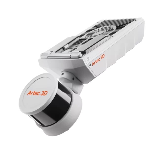
Artec Jet is a high-speed mobile LiDAR mapping system that combines SLAM-based positioning and AI-powered autonomy to capture sites, facilities & infrastructure, even in GPS-denied environments – in minutes rather than hours, with survey-grade accuracy.
From real scenes to digital twins in minutes
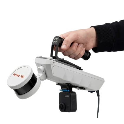
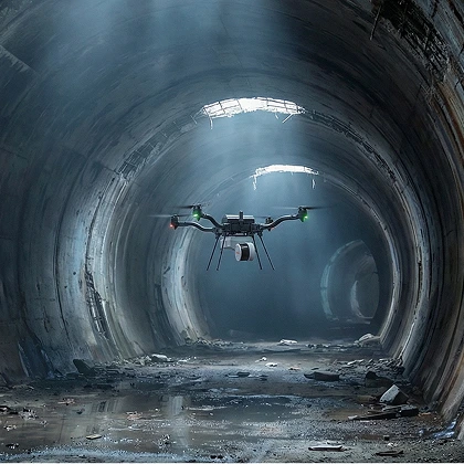
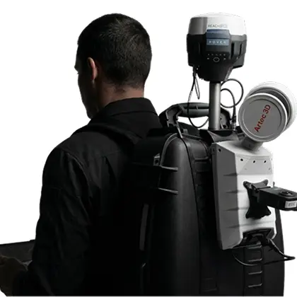
Capture by hand, or mount to a backpack, robot, vehicle, or drone. Artec Jet offers multiple different deployment modes in a single compact, lightweight device. Choose the modality that best suits your application, whether it be open-air surveying or underground mapping, and ensure that on-site teams steer clear of hazardous, hard-to-reach areas.
Within the mining, construction, defense, public safety, and civil infrastructure industries, Artec Jet captures accurate data, ideal for digital twins, as-built documentation, volumetric measurement, clash detection, and inspection.
Together with Artec Ray II and Leo, scanners well-suited to large-object and fine-detail capture, Artec Jet enables a complete pipeline for digitizing everything from sites to components.
Technical Specifications
Mapping accuracy (general environments)
±15 mm (19/32 in)
Mapping accuracy (indoor/underground)
±10 mm (3/8 in)
Change detection capability
±5 mm (7/32 in)
LiDAR range
0.5–300 m (1.6–984 ft)
Data acquisition (single return)
Up to 640,000 pts/s
Data acquisition (triple return)
Up to 1,920,000 pts/s
Field of view
360° × 290°
Laser class
Class 1 (eye safe)
Artec Jet Key Features
Real-time feedback
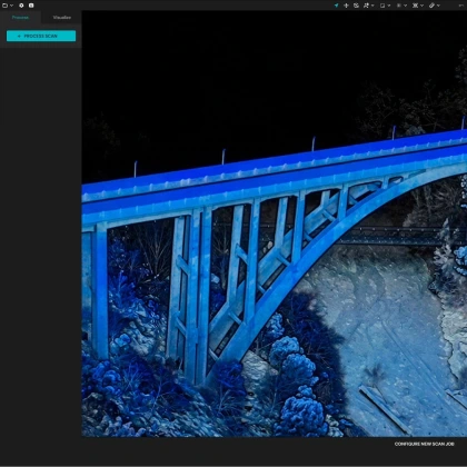
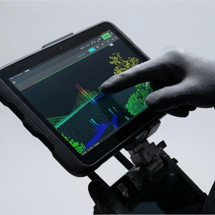
Artec Jet streams live point cloud previews to a companion app during scans, giving instant confirmation that all data is captured and no rescanning is required.
360° scene capture
With a 360° × 290° field of view, Artec Jet captures dense, shadow-free point clouds with full coverage in a single pass.
Color capture
Combine LiDAR data with imagery from a supported camera to create vivid, true-to-life 3D representations with immediately recognizable features.
GNSS-assisted georeferencing
Take advantage of satellite positioning with RTK accessories that improve global accuracy and reduce reliance on control points.
Instant proficiency
Push-button scanning with a plug-and-play design. No specialist training needed — start capturing quality data right away.
On-site verification
Preview each scan on-site before leaving to ensure complete, usable data is captured on every visit.
Explore Real-World Datasets
Concert hall
As this city center concert hall shows, building exteriors can get pretty elaborate. Navigating such busy locations can also make it difficult to capture clear, usable information. But Artec Jet made the process easy. Walking around the building with a backpack, capturing a complete dataset, and turning the scan into a usable point cloud took less than half an hour.
Underground iron mine
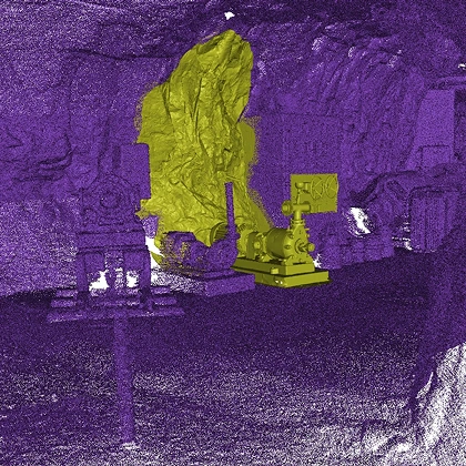
Captured deep underground in an iron mine, this dataset demonstrates how SLAM-based LiDAR mapping can be used to scan in environments where GPS navigation is unavailable. The irregular geometry, narrow passages, and dusty spaces make this a challenging scenario for most scanning technologies. Usually, operating in light-restricted environments also makes it difficult to identify and capture dark surfaces, but this was no problem for Artec Jet.
Castle
This massive point cloud was captured during a visit to a historic castle that was open to the general public. Though drone access was restricted, Artec Jet could be strapped to a backpack and simply walked around the facility for continuous data acquisition. The final results offer valuable context to potential renovators, as trees, rivers, and buildings are captured in situ.
Power lines
Rather than scaling these 60-meter-tall towers, our operator scanned from the ground. Artec Jet features a 300-meter scanning range, so it was possible to deploy in handheld mode, walking the length of the scene while capturing pylons, cables, and surrounding terrain. In less than an hour, they’d completed three laps of the area – enough to maximize point cloud density.
Sailing boat
This dataset demonstrates the capability of SLAM LiDAR to accurately capture large objects with complex geometric detail in a short amount of time. Working in handheld mode allowed for rapid, flexible data acquisition. The craft itself is also made from glossy, tricky-to-scan fiberglass, but as you can see, Artec Jet managed to achieve full scan coverage.
Indoor ice rink
Large open spaces like ice rinks can be deceptively difficult to digitize. They may appear simple, but overhead steel framework, lighting rigs, and ventilation ducts create a dense web of geometry that ground-based scanners can barely see, let alone capture accurately. That’s why Artec Jet was deployed to document these overhead structures without any need for scaffolding, lifts, or time-consuming tripod-based capture.
Heritage site
In this case, Artec Jet was used to digitize remnants of a historical fort in an urban environment. The irregular geometry – and the way it blurs into the surrounding cityscape – makes the site quite a challenging scan. Even so, Artec Jet managed to capture all the details, including those obscured by foliage, along with very different surfaces ranging from metal posts to brickwork.
Workshop
Capturing an active workshop, where dust and moving equipment can impact data acquisition, is no mean feat. But the ultra-versatile Artec Jet made quick work of it! Switching from handheld to drone-based capture allowed for comprehensive coverage – of both the ground-level and elevated structures. Everything from machinery to piping is featured in the final result.
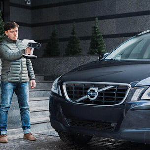
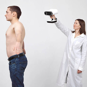
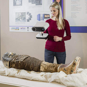
Safe to use Artec 3D Scanner uses invisible VCSEL structured light projection, making it totally safe for scanning people, as well as inanimate objects. Because of VCSCEL light technology, scanning is possible even in outdoors conditions
Just point and shoot No need preparation such as pasting targets and calibration, just simply plug in the scanner and point it around the object as you would with a video camera. Point scanner closer to object to zoom in for sharper details
Scan fast with geometry and texture tracking Artec 3D Scanner uses built-in accelerometer, gyro and compass to know its position in real world. Together with reading of scanned object’s geometry and color, fast and smooth scanning is possible even for large featureless object
SDK integration and scanners bundling Artec SDK allows you to integrate Artec scanners into your own custom solutions free of charge. Also, to capture larger area, several scanners can be bundled and synced together
Applications for Artec 3D Scanners
Industrial design and manufacturing
Reverse engineering
Quality control
Rapid prototyping
Aerospace
Healthcare
Orthopedics
Prosthetics
Plastic surgery
Custom wheelchairs
Dentistry
Hearing Aids
Science and education
Research
Training
Online museums
Forensic
Art and design
Heritage preservation
Architecture
CGI
Fashion
Additional Benefits
Special price for 3D software bundle
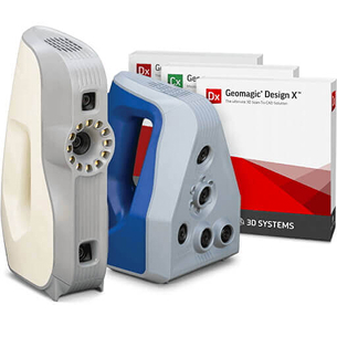
When purchasing Artec 3D scanner, enjoy special discount for 3D design and inspection software from Autodesk Manufacturing Solution, 3D System Geomagic and EGS Leios
Attractive offer for schools and universities
Education institutes are entitled to purchase Artec scanner at special EDU pricing, which includes free 20 licenses of Artec Studio 3D software, 2 years hardware warranty and software upgrades
Smart, easy scan processing software
Smart Autopilot mode in Artec Studio software provides new and experienced users the most seamless workflow to process 3D scanning data and produce reliable results. Also enjoy the fastest processing speed yet in latest Artec Studio version
Faster 3D scanning vs. laser scanners
Artec handheld 3D scanners capture entire surface area per scan, while laser scanners capture only the small area over which the laser line pass. Artec scanners are also cost effective, portable and require no target marker pasting
We are specialists in 3D Scanning, 3D Scanners and CAD / CAM software, serving the industry since 1996. Engage our expertise for your small batch prototypes production, and 3D design and manufacturing solutions.